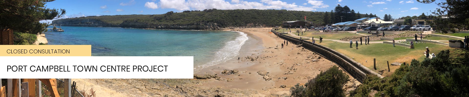
FAQs
What has happened so far?
MAY 2017 Corangamite Shire allocated $1 million in the 2017-2018 Budget towards the Port Campbell Town Centre Improvement Project.
JUNE 2017 Fifteen residents nominated to be part of a Community Reference Group (CRG) chaired by Coastal Ward Councillor Simon Illingworth. A Project Control Group with representatives from Parks Victoria, Regional Development Victoria, Great Ocean Road Regional Tourism and Twelve Apostles Tourism and Business Association was also formed to provide project input and advice.
AUGUST 2017 Hansen Partnership and Terroir were appointed to lead the conceptual and detailed design stages.
OCTOBER 2017 A two-day design workshop was held in Port Campbell. This is where the designers (Hansen Partnership) held ‘ideas and directions’ sessions with the Project Control Group and the Community Reference Group. Members of the community were also invited to a drop-in session to discuss ideas and local priorities.
DECEMBER 2017 The Community Reference Group called an additional public meeting which heard more ideas for the proposed concepts.
JANUARY 2018 A set of initial concept plans, ideas and sketches(PDF, 5MB) was completed and circulated for comment between 10 January to 12 February. A public information session was held at the Artspace and plans were displayed online and at different points in Port Campbell. Residents were invited to have their say by completing a survey.
MARCH 2018 Council received 153 responses to the survey. 98% of responses were from local residents. Council officers and the design team met with the Project Control Group and Community Reference Group to present findings.
JULY 2018 With the Cairns Street / Foreshore area a sticking point, four different design options for this area were circulated for community feedback from 10 July to 3 August. Residents were invited to have their say by completing a survey. Council received 107 survey responses.
AUGUST 2018 A petition of 271 signatures was presented at the Council meeting. It proposed to “Keep the Port Campbell foreshore accessible to everyone by retaining the current amount of car parks along the foreshore and ensure the continuation of two-way traffic,” as a fifth option for consideration. The Victorian Design Review Panel independently reviewed the Port Campbell Town Improvement Project and provided advice to Corangamite Shire.
FEBRUARY 2019 After extensive community consultation, Council developed a revised concept plan for the Port Campbell Town Centre Project.
MARCH 2019 The revised concept plan was adopted at the March Council Meeting.
AUGUST 2019 The revised schematic design shared with the community. Drop-in sessions held with traders and the community at the end of August.
NOVEMBER 2019 Council at its November 2019 Council meeting adopted a Schematic Design Plan. The adopted Schematic Design Plan was informed by public consultation.
JULY 2020 Renowned artist and Keerray Wooroong woman Dr Vicki Couzens selected as the artist to be involved in the integrated artwork component of the project.
AUGUST 2020 The Port Campbell Town Centre project is a step closer to reality, with Council adopting detailed designs at the August meeting.
JULY 2021 State Government commits $6M to the Port Campbell Town Centre Revitalisation Project.
OCTOBER 2021 Federal Government commits $5.6M to the project meaning works can get underway.
NOVEMBER 2021 Community Reference Group appointed.
DECEMBER 2021 Town Centre Project tender was advertised.
FEBRUARY 2022 Tender closes for this project. No tenders received. Council to use feedback from construction companies to consider alternate options for procurement.
APRIL 2022 The vacant Alcove Café building becomes a site office for construction, giving residents a place to drop in for updates.
MAY 2022 Council calls for tenders on the works package.
AUGUST 2022 Council appoints a project manager to oversee smaller sections of work to go ahead with individual contractors, after a tender process fails to identify suitable submissions.
OCTOBER 2022 Council seeks expressions of interest from contractors for design and construction of major parts of the project.
SEPTEMBER 2022 Carparking plans revised following community feedback.
FEBRUARY 2023 Tregea Street/Morris Street footpath completed.
APRIL 2023 Council selects Warrnambool company Civil now as contractor for the $5.15M 2023 works. Works to include timber decking lookout and picnic areas, new treatment on Lord Street surface, new pavement on Cairns Street, street furniture, lawn areas, garden beds, pathways and art by Dr Vicki Couzens.
JULY 2023 Corangamite Shire Council signs the 2023 Works Package contract with Civilnow, for the major part of the revitalisation project.
AUGUST 2023 Site preparation works start, focusing on the lower section of Lord Street near the Norfolk Island Pines, and the foreshore.
SEPTEMBER 2023 A dying Norfolk Island pine is removed from the Port Campbell Foreshore, making way for extended decking. Site preparation works in Lord Street and the foreshore.
OCTOBER 2023 Federal Senator Raff Ciccone officially breaks ground on the first large stage of the Port Campbell Town Centre Revitalisation Project. Construction includes a new deck, limestone walls, pavement and landscaping in Lord Street; and retaining walls, footpaths and complete landscaping on the foreshore.
OCTOBER-DECEMBER 2023 Install new deck, limestone walls, new concrete asphalt pavement, and landscaping in lower Lord Street. Install retaining walls, new footpaths and furniture, complete landscaping on foreshore.
NOVEMBER 2023 Community input sought on the integrated art component of the town centre project.
DECEMBER 2023 - JANUARY 2024 Works on the foreshore and lower Lord Street paused for the peak visitor period.
FEBRUARY 2024 Works resume, including new garden bed walls. Focus moves to Tregea Street, converting parking bays to 90-degree angle, new kerbing, accessible parks, road resurfacing and tree planting.
JULY 2024 Retaining walls and footpaths on the foreshore completed, with access to the first set of beach stairs and public shower reinstated. Lord Street roundabout nearest the foreshore removed and new street lighting installed.
SEPTEMBER 2024 The improved foreshore area reopens to the public. Community workshops to design a wayfaring mosaic with artist Dr Vicki Couzens.
NOVEMBER 2024 Constriction starts on decking underneath the Norfolk Island pines in Lord Street.
DECEMBER 2024 Car parking in foreshore area completed. Foreshore is fully open to the public. Base layer of asphalting in Lord Street. Pebblecrete footpath completed on eastern side of Lord Street. Installation of mosaic tiles begins.
JANUARY 2025 Work resumes after brief Christmas break. Final finishing works ahead of project completion.
Why is the width of the road in lord street narrower than the design plan?
Lord Street, as a shared zone, is intentionally designed to meander in order to slow vehicles down. This means that the road width varies with the narrowest point at 6.0m including the grated drain. While the architectural design plan indicated a desired width of 7.0m, the engineering construction design had to take into consideration the location of services, drainage, property boundaries, disability access and other regulatory requirements. The change between architectural design to engineering construction drawings is not unusual in civil construction projects.
The new road width for Lord Street past the police station is the same width also. The minimum lane width required is 5.5m for two lanes, which allows vehicles (semi-trailer or smaller) to pass each other on the roadway at 5.5m (2.75m per lane). Many high-speed rural roads (100km/h) are based on a seal width of 5.5m to 5.8m wide.
Is a 20 kilometres per hour speed limit slow enough for the shared zones in Lord street and Cairns street?
20km/h provides a high degree of safety to all road users. Information and analysis by VicRoads and Transport Accident Commission (TAC) shows improved safety outcomes for vulnerable road users at this reduced speed. The speed limit has been approved by VicRoads and all safety implications considered for the reduction of the limit from 30km/h to 20km/h.
Why has the original project budget been exceeded? How is this being funded?
The project is funded jointly by Council, the State Government and Federal Government. The Project has faced unforeseen costs including unmapped asbestos and service infrastructure that has required redesign, additional construction works and program rescheduling; delays in power shutdowns requiring contractors to work in a ‘live’ site impacting on time and requiring further program rescheduling; existing road subsurface being inadequate to reuse requiring additional asphalting. These impacts have also resulted in time delays that require additional traffic management and resources.
All of these unforeseen costs have resulted in the original project budget being exceeded. The additional project budget is being funded by Council.
Will Lord street be made into a permanent one-way street?
Lord Street has been made into a one-way street for the construction phase of the project. Lord Street will return to two way traffic at the completion of project.
When will the project be finished?
The project is on track for the major elements to be completed by 31 March, with some residual elements (example – planting) to be undertaken in Autumn.
What is the background to the Decks under the Norfolk Island Pines?
The current concept design for the decks - that is the seven round pod shapes, with timber platforms, timber cladding and sawtooth edges - was the concept and schematic design approved at the Council meeting in August 2020.
Construction Documentation was undertaken after the August 2020 Council meeting and involved technical input from respective regulatory bodies and agencies.
With the exception of some engineering changes to the footings (from cantilevered platforms on a large pillar to the Surefoot design) and consequent down-sizing and minor shifting of platform locations to avoid tree roots and geotechnical challenges, the construction designs for the decks do not differ from the approved Design Development drawings.
Early in the design process, initial concepts in 2018 showed rectangular platforms with several jutting out beyond the canopy of the Norfolk Pines across the cliff line, most with step-down and level changes presenting accessibility challenges. Following feedback, which was provided at in-person community meetings, online and at co-design workshops held in Port Campbell, the rectangular platforms were replaced with round decks with enclosed areas featuring timber cladding. The concept designs were reviewed by the Victorian Government Architect Design Review Panel. The first versions of the round, more enclosed concepts were put forward in 2019 to a briefing of Council and developed further by the design architects, the Community Reference Group and the Project Working Group during 2019 and 2020.
Why is there a change in level from the decks nearest the rocket shed and the footpath? How will they meet the footpath? Is this an error?
There is no error in footings or elevations for any of the decks. Deck 7 (the one nearest the Rocket Shed) will have the same timber at the same grade as the footpath. A step down onto the deck proper is being built as part of the approved construction drawings. This step down is intentional and provides for direct access from the footpath to Deck 7. Decks 6 and 7 have been designed so that wheelchair users can safely travel down and around and onto deck 7 via deck 6.
The early concept designs for the decks had a step down onto decks 7, 5, 3 and 1 effectively meaning no wheelchair access at all. This has been resolved with the tie-in links between the footpath and decks 7, 5 and 2. All Abilities Access will be provided to all decks. Decks 7 and 6, closest to the Rocket Shed, remain at a lower similar level to the remainder of the decks along Lord Street south.
What is happening with the cladding for the balustrades?
Minor modifications are being implemented to the balustrade cladding. Stainless steel tensioned wire on the bay facing side of decks #1, #4 and #6 will replace the angled timber, and the timber boards will be lowered by two boards on the footpath side of decks #1, #4 and #6.


What works are happening at the Surfers Carpark (Old Great Ocean Road)?
The approved Design Plan for the headland trail along the Old Great Ocean Road involved closure of the remnant section of the Old Great Ocean Road between the Surfers Carpark and the Memorial, removal of the pavement and surfaces of the Old Great Ocean Road and replacement with a boardwalk, viewing platforms and revegetation between the Fisherman’s carpark and the Surfer’s carpark. Following community consultation, the Design Plan was approved in August 2020. However regulatory approval to enable the design to be constructed was not able to be obtained. A lesser-impact design was subsequently developed following advice from Heritage Victoria to retain the alignment, surfaces and materials that form that portion of the old Great Ocean Road. This alternate design was put to the Project Technical Reference Group and the Project Control Group and advice provided to the Community and Business Reference Group.
The alternate design retains the road as is but formalises carparking spaces on the northern side of the road shoulder, within the existing road reserve. Following feedback from the CBRG, and geotechnical and drainage concerns, the carparking spaces initially proposed for the cliff-side of the Surfers Carpark were removed from the revised plan. The installation of bollards across the old pavement to the west of the carpark is to prevent vehicles, other than Emergency Services, from travelling along this section of the old Great Ocean Road. The bollards have been placed to align with the end of the boardwalk area in the initial approved design plan and to ensure that pedestrians and cyclists are able to safely use that section of the old Great Ocean Road.