We use cookies to ensure our site functions properly and to store limited information about your usage. You may give or withdraw consent at any time. To find out more, read our privacy policy and cookie policy.
Manage Cookies
A cookie is information stored on your computer by a website you visit. Cookies often store your settings for a website, such as your preferred language or location. This allows the site to present you with information customized to fit your needs. As per the GDPR law, companies need to get your explicit approval to collect your data. Some of these cookies are ‘strictly necessary’ to provide the basic functions of the website and can not be turned off, while others if present, have the option of being turned off. Learn more about our Privacy and Cookie policies. These can be managed also from our cookie policy page.
Strictly necessary cookies(always on):
Necessary for enabling core functionality. The website cannot function properly without these cookies. This cannot be turned off. e.g. Sign in, Language
Analytics cookies:
Analytical cookies help us to analyse user behaviour, mainly to see if the users are able to find and act on things that they are looking for. They allow us to recognise and count the number of visitors and to see how visitors move around our website when they are using it. Tools used: Google Analytics
Share Curdies Catchment Flood Study on FacebookShare Curdies Catchment Flood Study on X (formerly Twitter)Share Curdies Catchment Flood Study on LinkedinEmail Curdies Catchment Flood Study link
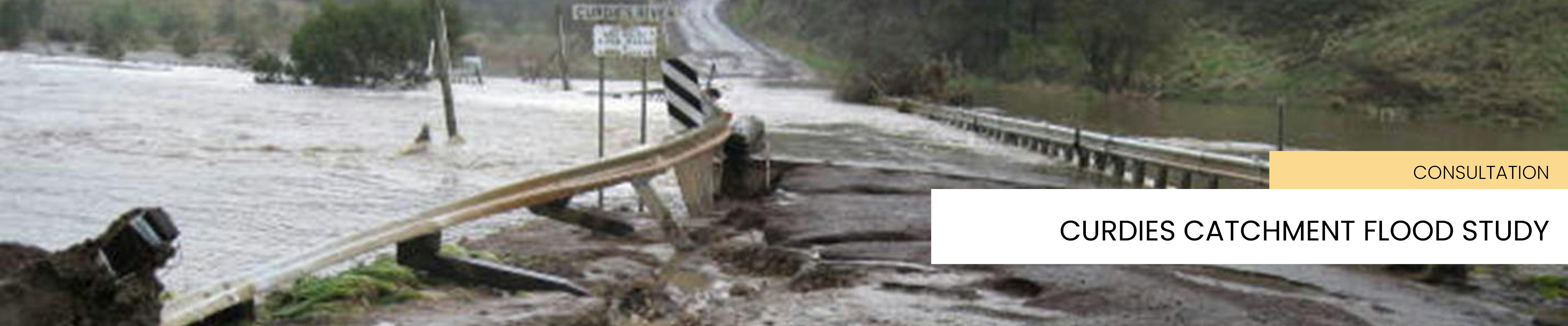
We’re working on a detailed flood study on the Curdies River catchment, from Purrumbete down to Peterborough, but excludes the Scotts Creek and Cooriemungle Creek catchments, to determine flood levels and extents in the catchment, such as riverine, flash, and overland flooding.
We would like to invite you to join us at a drop-in session to get a project update on the Curdies Creek Catchment Flood Study project.
We are also requesting your help in verifying the flood modelling that has been completed so far by sharing your flood experiences and ideas about flood mitigation
Or by stopping in at one of the following two sessions facilitated by Michael Clarke, Senior Engineer from Water Technology:
Thursday 28 August
Coden Civic Hall, 53-55 Victoria Street, Cobden, 10.30 am-12.30 pm
Timboon Senior Citizens Centre, 30 Bailey Street, Timboon, 1.30-3.30 pm
3. One on one
If you can’t make it to a drop-in session, you can arrange for a one-on-one consultation with the project team. Please contact Jennie Schoof on 5593 7100.
BACKGROUND
This project is in partnership with the Corangamite Catchment Management Authority and Moyne Shire Council.
The Flood Study will provide detailed modelling and mapping to define flood levels and extents for different rainfall events and assess the potential impact of flooding on properties, roads and other assets.
The project will model historic events and consider the impacts of climate change on flooding, and will inform changes to the planning scheme based on the mapping.
We’re seeking the public’s help to make sure the study draws on community knowledge and details of past floods. You can help us by sharing your recollections, insights, measurements and images of past flooding events on rivers and waterways as well flash flooding and overland flooding events anywhere in the catchment.
The Curdies Catchment Flood Study will be used by councils, CCMA, SES and other emergency agencies to:
Inform decisions about flood warnings and emergency response, for example proactively closing roads before they are inundated.
Update Planning Schemes to ensure that land controls protect properties from flooding and contain increases in future flood risk.
Inform infrastructure planning, including implementation of structural flood mitigations such as drainage.
Increase community awareness and preparedness for flood emergencies.
Update the municipal flood emergency plans, local flood guides and the Victorian Flood Database.
The Flood Study will help reduce flood risks by reducing threat to life and property and flood-related damages in the catchment.
Can we please add that the project is jointly funded by the Victorian Government, CCMA and Corangamite Shire Council.
Submissions close 5 pm, Monday 8 September.
For more information, call us on 5593 7100.
We’re working on a detailed flood study on the Curdies River catchment, from Purrumbete down to Peterborough, but excludes the Scotts Creek and Cooriemungle Creek catchments, to determine flood levels and extents in the catchment, such as riverine, flash, and overland flooding.
We would like to invite you to join us at a drop-in session to get a project update on the Curdies Creek Catchment Flood Study project.
We are also requesting your help in verifying the flood modelling that has been completed so far by sharing your flood experiences and ideas about flood mitigation
Or by stopping in at one of the following two sessions facilitated by Michael Clarke, Senior Engineer from Water Technology:
Thursday 28 August
Coden Civic Hall, 53-55 Victoria Street, Cobden, 10.30 am-12.30 pm
Timboon Senior Citizens Centre, 30 Bailey Street, Timboon, 1.30-3.30 pm
3. One on one
If you can’t make it to a drop-in session, you can arrange for a one-on-one consultation with the project team. Please contact Jennie Schoof on 5593 7100.
BACKGROUND
This project is in partnership with the Corangamite Catchment Management Authority and Moyne Shire Council.
The Flood Study will provide detailed modelling and mapping to define flood levels and extents for different rainfall events and assess the potential impact of flooding on properties, roads and other assets.
The project will model historic events and consider the impacts of climate change on flooding, and will inform changes to the planning scheme based on the mapping.
We’re seeking the public’s help to make sure the study draws on community knowledge and details of past floods. You can help us by sharing your recollections, insights, measurements and images of past flooding events on rivers and waterways as well flash flooding and overland flooding events anywhere in the catchment.
The Curdies Catchment Flood Study will be used by councils, CCMA, SES and other emergency agencies to:
Inform decisions about flood warnings and emergency response, for example proactively closing roads before they are inundated.
Update Planning Schemes to ensure that land controls protect properties from flooding and contain increases in future flood risk.
Inform infrastructure planning, including implementation of structural flood mitigations such as drainage.
Increase community awareness and preparedness for flood emergencies.
Update the municipal flood emergency plans, local flood guides and the Victorian Flood Database.
The Flood Study will help reduce flood risks by reducing threat to life and property and flood-related damages in the catchment.
Can we please add that the project is jointly funded by the Victorian Government, CCMA and Corangamite Shire Council.